Watsons Bay and the Gap — harbour village, cliffs, and the ferry
Is Watsons Bay worth visiting and how do I get there?
Yes — Watsons Bay is a pleasant half-day trip from the CBD combining harbour views, the Gap cliff walk, a beach (sheltered harbour side), and ferry return. The ferry from Circular Quay takes 30–35 minutes and costs AUD 8.50 on Opal. Doyle's seafood restaurant is genuine quality but expensive.
What Watsons Bay is
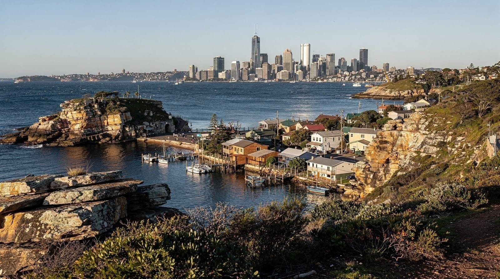
Watsons Bay occupies a small peninsula at the South Head of Sydney Harbour — the narrow strip of land between the harbour entrance and the ocean. It is primarily a residential suburb, dense with heritage Federation-era cottages and modern renovations, commanding a position that put it among the most expensive real estate in Sydney.
For visitors, Watsons Bay offers three distinct things: the Gap (a dramatic cliff walk on the ocean side), a sheltered harbour beach (Camp Cove and Nielsen Park are nearby), and one of Sydney’s most historically connected seafood restaurants. The ferry from Circular Quay makes it a practical half-day trip.
Getting there
Ferry (recommended): From Circular Quay Wharf 4 (or Wharf 4/5 depending on service), Transdev operates the F2 Taronga Zoo Ferry which continues to Watsons Bay. Journey time approximately 30–35 minutes. Opal card accepted, approximately AUD 8.50 each way.
Check the Transport NSW app for current timetables — services are less frequent than the Manly ferry and can be an hour apart in off-peak periods.
Bus: Route 324 or 325 from Circular Quay, taking approximately 30–40 minutes depending on traffic. The bus stops at Nielsen Park and Watsons Bay. This is an Opal service and is slightly cheaper than the ferry.
Car: 14 km from the CBD via Eastern Distributor. Parking is available in the suburb but limited on weekends.
The Gap
The Gap is a coastal clifftop walk on the ocean side of the Watsons Bay peninsula, looking south-east across the Tasman Sea. The cliffs drop approximately 25 metres to the water and the sea conditions here — particularly in southerly swells — are visibly dramatic.
The walkway has been progressively improved in recent years. The Robertson Park at the top end has views across the harbour entrance toward Manly and North Head. On clear days you can see the surf at several northern beaches from this vantage point.
The Gap is open all day and entry is free. A Salvation Army Lifeline Beacon (a crisis support phone and sign) was installed here decades ago — the location’s history as a site for suicide attempts is part of the public record, handled sensitively in the current interpretation materials at the viewpoint.
Walk duration: 20–30 minutes from the Watsons Bay ferry wharf to the Gap and back. Combined with the harbour beach and a cafe stop, allow 2–3 hours total.
Camp Cove and Nielsen Park
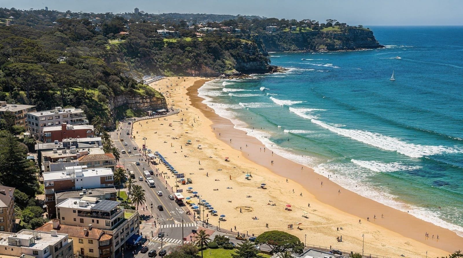
Camp Cove is a small harbour beach approximately 600 m south of the Watsons Bay ferry wharf. The beach faces the harbour entrance and catches significant afternoon sun. The water is calm harbour water — no surf, no rip currents, typically clear. Patrolled in summer.
Nielsen Park (Shark Beach) is a national park reserve further along the headland, accessible via a 15-minute walk from Camp Cove. It has a shark-netted harbour swimming area, a heritage building, and significant trees that provide shade — one of the most pleasant picnic settings in Sydney. Access by bus 325 as well as on foot.
Doyle’s at the Beach
Doyle’s at Watsons Bay has been serving seafood from this location since 1885 and is one of Sydney’s most historically continuous restaurants. The harbour outlook is excellent; the food quality has been broadly consistent through multiple generations of the Doyle family.
What it costs: Mains AUD 38–65. Fish and chips from the adjacent takeaway stand AUD 18–26. The takeaway fish and chips, eaten on the wharf overlooking the harbour, represents better value than the sit-down restaurant for most casual visitors.
Honest assessment: Doyle’s charges a location premium that is significant. The seafood is good but not exceptional by Sydney standards. For the price, you are paying for the heritage address and the harbour view as much as the food. If budget is a consideration, the takeaway option delivers the same view with the same fish at less than a third of the sit-down price.
Tourist trap caveat: Some visitors are disappointed by Doyle’s because expectations from its reputation are high. The food is dependably good rather than outstanding. Approach it as a nice pub-quality harbour seafood meal with a heritage backdrop, not as a fine dining destination.
Sunset from Watsons Bay
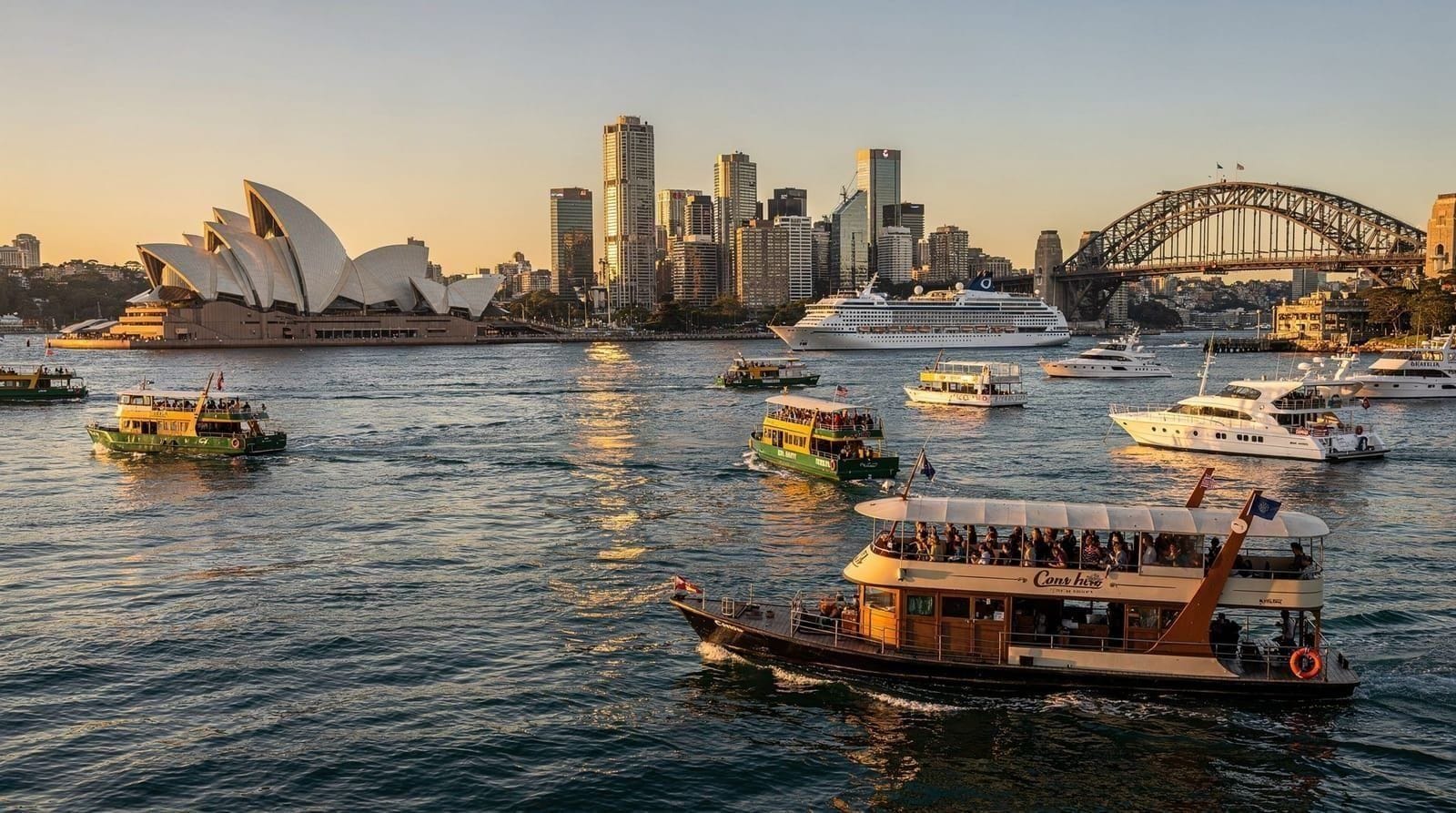
The western-facing harbour side of Watsons Bay receives the afternoon sun directly, and sunset from the Robertson Park viewpoint or the ferry wharf looks directly across the water toward the Opera House, Harbour Bridge, and the city skyline. This is one of the best free sunset viewing positions in Sydney for the harbour as a whole.
Timing: Plan to be at the wharf approximately 30 minutes before sunset. Catch the last ferry after dark — check the timetable and err on the side of caution, as evening services are less frequent.
In context: For harbour sunset viewing with a drink, a harbour cruise is an alternative that moves through the view rather than anchoring at one point — the Sydney harbour sunset cruise guide covers the boat options.
What to do in Watsons Bay — a half-day structure
Arriving by ferry (9:30 am): Walk from the wharf to the Gap (20 min). Walk the cliff top path. Return to Camp Cove for a swim (30 min). Walk to Robertson Park for harbour views. Fish and chips from Doyle’s takeaway on the wharf. Return ferry to Circular Quay.
Total time: 3–4 hours. Approximate cost: Ferry AUD 17 return + fish and chips AUD 20 = AUD 37.
If combining with Nielsen Park: add a bus leg and another hour; bring a picnic.
South Head Heritage Trail
Beyond the immediate Gap viewpoint, a longer walking trail follows the headland south through the Sydney Harbour National Park to South Head itself — the southern entrance point to the harbour. The trail covers approximately 2.5 km from the Gap carpark to South Head lighthouse and back, passing through native coastal scrub with views east to the open ocean and west across the harbour.
The Hornby Lighthouse at South Head (1858) is a heritage-listed structure that guided ships into the harbour in the colonial era. It is not open for interior visits but the surrounding area is accessible and provides the clearest possible view of the narrow passage between North Head and South Head that formed the geographical key to Sydney’s establishment as a port.
The Lady Bay Beach: Partway along the South Head trail is a small, secluded harbour beach accessible by a steep track from the main path. Lady Bay is Sydney’s only official nudist beach. The beach itself is sheltered and the water is calm; it has functioned quietly in this capacity for decades with minimal public controversy.
Trail duration: The full South Head return from the Gap is approximately 1.5 hours at a comfortable pace. Combine with the harbour beach swim and the ferry for a 4–5 hour day.
Access: The South Head Heritage Trail is managed by the NPWS (National Parks and Wildlife Service). Entry to the national park is free. The trail is marked; no specialist navigation required.
Nielsen Park
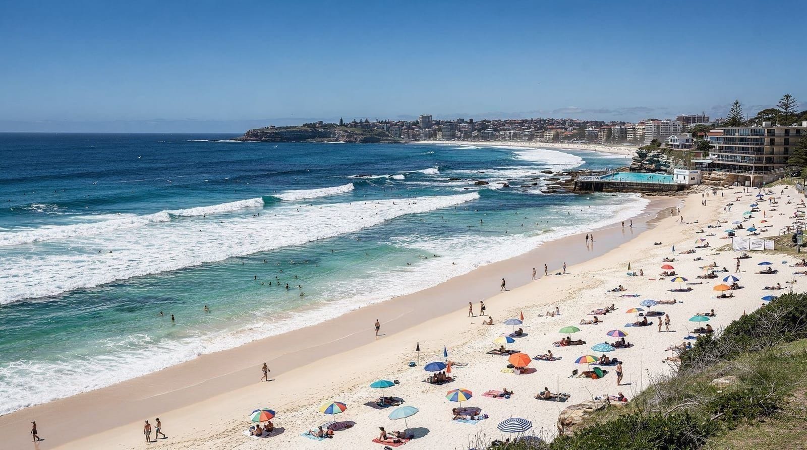
Nielsen Park (formally Shark Beach) is accessible from Watsons Bay by a 20-minute walk south along New South Head Road and through the park, or by the Bus 325 from the Gap. It deserves separate mention because it represents something unusual in Sydney: a genuine national park beach within 15 km of the CBD.
The beach is about 300 m of sand in a sheltered bay, enclosed by shark nets and patrolled in summer. The surrounding Greycliffe House (1851) and the national park vegetation are in better condition than the equivalent settings at Manly or Bondi. The picnic grounds under the old fig trees are genuinely good, and the beach is never as crowded as the ocean beaches because it requires slightly more effort to reach.
Entry to the national park is free. A small NPWS kiosk operates in summer.
History of the area
Watsons Bay takes its name from Robert Watson, a harbour master who lived on the point in the early colonial period. The area was used as a pilot station — vessels approaching Sydney Harbour signalled for a pilot from Watson’s station to guide them through the Heads. The pilot boat service operated for most of the nineteenth century.
Camp Cove (the small beach south of the ferry wharf) is historically significant as the site where Governor Phillip’s boats first landed on the southern harbour shore in January 1788, the day before the colony formally established at Sydney Cove. A small interpretive plaque marks this; the setting has changed considerably in 238 years.
The military has had a presence on the South Head peninsula since 1791, and several of the walking track restrictions in the area reflect the boundaries of current defence facilities.
Weather and best conditions
The South Head peninsula is exposed to south-easterly winds that funnel through the Heads from the ocean. In strong south-easterlies (common in spring and summer), the Gap is spectacular — waves drive against the cliff face with significant force — but the walk can be uncomfortable and the ferry crossing rougher than usual.
Calm, clear days from autumn through to early winter are the most pleasant for the walk, the swimming, and photography. Winter mornings with calm seas produce the most dramatic harbour light from the Robertson Park viewpoint.
In summer heat (January–February), the headland offers limited shade. Bring water and sunscreen regardless of season.
Accommodation near Watsons Bay
Watsons Bay Hotel has a boutique hotel component with harbour-facing rooms (AUD 350–550/night) that are genuinely fine if you want to wake up to harbour light. The hotel also has a large beer garden (The Beach Club) open daily, with reliable food at fair prices by Sydney standards — a better value option for eating than Doyle’s sit-down restaurant for most visitors.
For budget accommodation, Double Bay and Bondi Junction (15–20 minutes by bus) provide significantly more options at lower prices with good transport connections.
Combining with other destinations
Watsons Bay connects naturally with the eastern suburbs. From the Gap, you can walk south along the headland track (described above) toward South Head. By bus from the wharf, Bondi Junction is 20 minutes away and links to Bondi Beach.
For visitors doing the Bondi to Coogee walk in the morning, a Watsons Bay ferry in the late afternoon creates a natural loop: east coast in the morning, west harbour in the afternoon, Circular Quay return.
For the full harbour experience — including Watsons Bay seen from the water — the Sydney harbour ferry guide covers the public ferry routes and the scenic alternatives. The eastern harbour route from Circular Quay to Watsons Bay via Double Bay and Rose Bay is among the more scenic of Sydney’s ferry journeys.
Budget
| Item | Cost |
|---|---|
| Ferry return (Circular Quay–Watsons Bay) | AUD 17 (Opal) |
| Bus alternative (return) | AUD 9–19 (Opal) |
| Doyle’s fish and chips (takeaway) | AUD 18–26 |
| Doyle’s restaurant (main course) | AUD 38–65 |
| Watsons Bay Hotel meal | AUD 22–35 |
| Gap and South Head walk | Free |
| Nielsen Park entry | Free |
| Camp Cove swimming | Free |
A comfortable half-day at Watsons Bay costs AUD 35–50 including transport and a fish and chips lunch. The longer South Head circuit is free and adds significant value for those with time.