Getting around Sydney — transport options, costs and honest advice
What is the best way to get around Sydney as a tourist?
Public transport (Opal card or contactless bank card) covers virtually everything tourists need — trains for the CBD and major destinations, ferries for Manly and Circular Quay harbour routes, buses for beaches and inner suburbs. A car is not needed for central Sydney but is useful for day trips to the Blue Mountains or Hunter Valley if you want full flexibility.
Sydney’s transport network — the overview
Sydney’s public transport network is extensive but has genuine limitations that visitors should understand before arriving. The train network covers the CBD and major residential corridors well. Ferries provide scenic harbour access and are genuinely useful rather than purely touristic. Buses fill critical gaps — particularly for beaches like Bondi, which have no train connection.
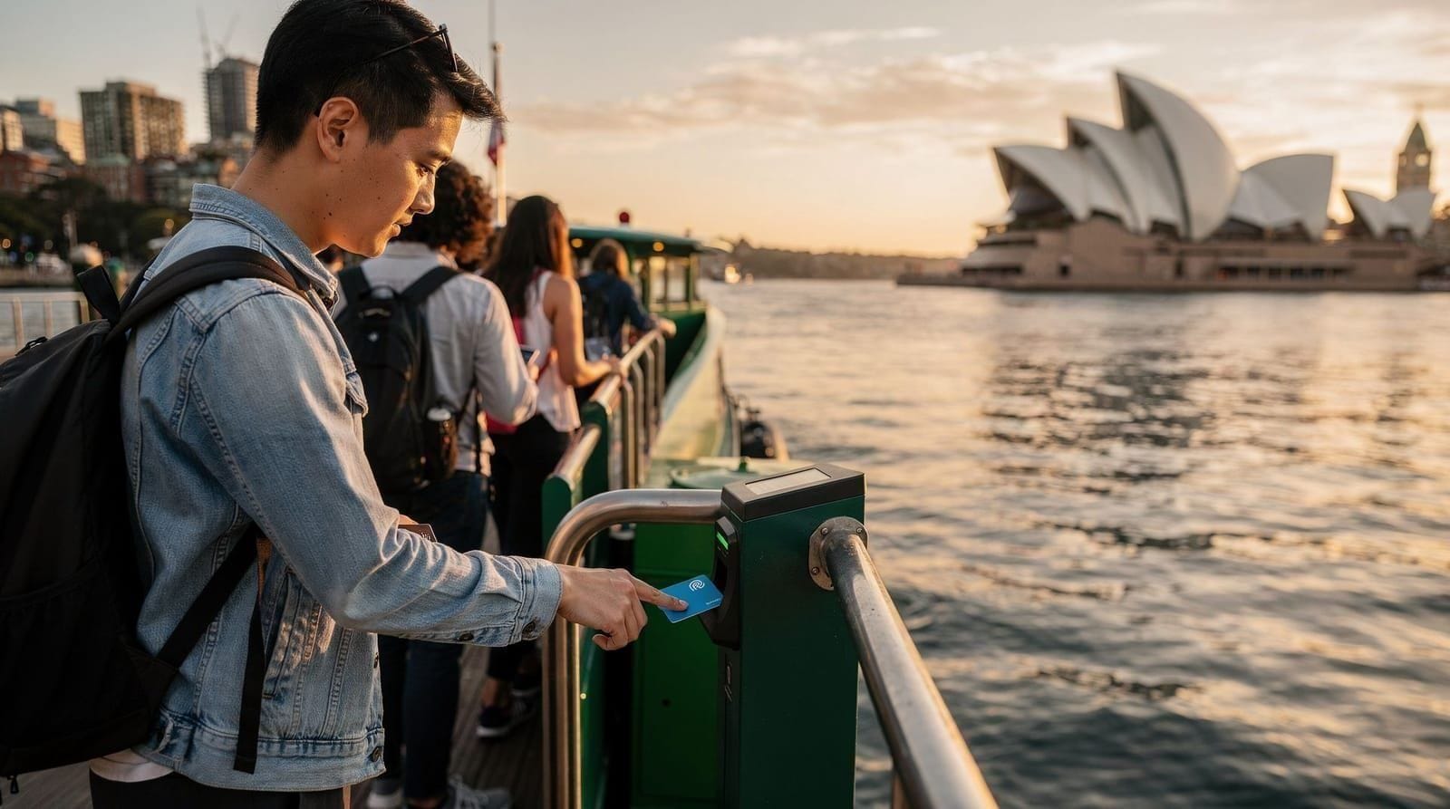
The network operates on the Opal card (or contactless Visa/Mastercard) with a daily cap of AUD 19.30 Mon–Thu and AUD 9.65 Fri–Sun, and a weekly cap of AUD 50. This pricing structure means a tourist who moves around frequently pays a capped amount regardless of how many journeys they make once the cap is reached.
The honest limitations: some important tourist areas are not well served by rail (Bondi Beach requires a bus change; the Northern Beaches beyond Manly require ferries and buses). Peak hour on the train network (7–9am and 4:30–6:30pm) is crowded to the point of discomfort on some lines.
Trains — the backbone of the network
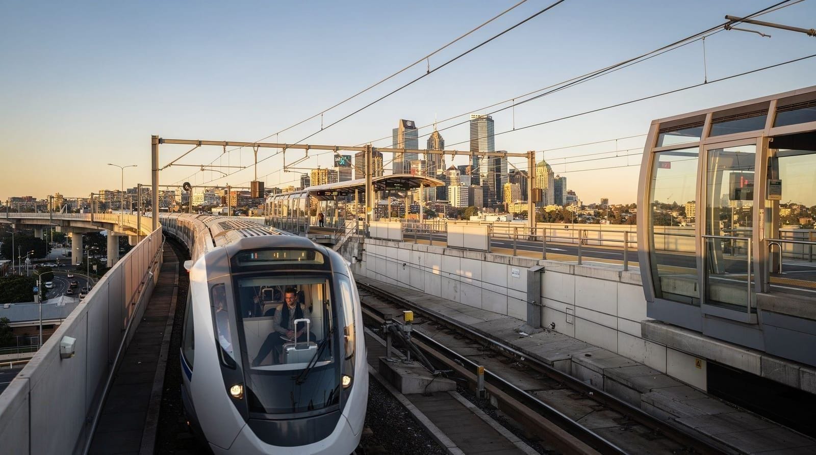
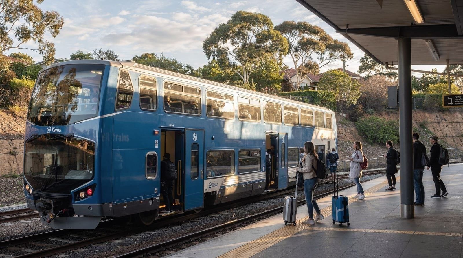
The Sydney Trains network comprises nine lines radiating from the CBD, with a City Circle loop connecting Central, Town Hall, Wynyard, Circular Quay, St James, and Museum stations. For tourists, the most useful lines are:
T4 Eastern Suburbs/Illawarra Line: Central → Town Hall → Wynyard → Circular Quay → Martin Place → Kings Cross → Edgecliff → Bondi Junction. This is the core tourist line — Opera House and The Rocks (Circular Quay), Darlinghurst and Paddington (Kings Cross), and the bus interchange for Bondi Beach (Bondi Junction).
T1 North Shore/Western Line: Connects the CBD to Parramatta (western suburbs) and to the North Shore (Wynyard → North Sydney → Chatswood direction). Also covers the Blue Mountains line — Katoomba for the Blue Mountains day trip is on this line, approximately 2 hours from Central.
Airport Line (T8): Central → Mascot → Domestic Airport → International Airport. The dedicated airport link. Note the higher fare due to the station access fee (~AUD 19 from CBD).
T2/T3/T7 for western suburbs and Parramatta.
Trains run frequently in the CBD — every 3–5 minutes on busy lines during the day. In the outer suburbs and off-peak, frequency drops to every 15–30 minutes. The Opal app or Google Maps shows real-time departures.
Ferries — scenic and practical
Sydney’s ferry network is operated by Transport for NSW and covers eleven routes from Circular Quay. Unlike many cities where a tourist cruise is separate from the working ferry network, Sydney’s ferry routes are used by commuters and visitors alike — you’ll share the Manly ferry with people going to work.
Key routes for visitors:
| Route | Time | Best for |
|---|---|---|
| F1 Manly | 30 min from Circular Quay | Beach, scenic harbour crossing, Manly Scenic Walkway |
| F2 Taronga Zoo (Mosman) | 12 min from Circular Quay | Zoo visit, harbour views |
| F5 Neutral Bay | 10 min from Circular Quay | North Shore access, short harbour crossing |
| F8 Watsons Bay | 30 min from Circular Quay | South Head, Watsons Bay village |
| Parramatta River | 1 hr+ from Circular Quay | Upstream views, Parramatta itself |
All routes operate on Opal card (or contactless). Private ferry operators — Captain Cook Cruises, Fantasea — run their own ticketing and are separate from the Opal system.
The Manly Ferry (F1) is consistently cited as one of the best value experiences in Sydney. The 30-minute crossing provides views of the Opera House, Harbour Bridge, North Head, and the open harbour that no land-based viewpoint replicates — included in the Opal daily cap.
See the Sydney ferries guide for complete route information and timetables.
Buses — essential for beaches
Sydney’s bus network covers areas not reached by train, most importantly the Eastern Beaches (Bondi, Bronte, Coogee) and the Northern Beaches (Dee Why, Narrabeen, Avalon, Palm Beach).
Key bus routes for visitors:
| Route | Covers | Journey from CBD |
|---|---|---|
| 333 | Circular Quay → Oxford St → Bondi Beach | 35–45 min |
| 380 | Circular Quay → Oxford St → Bondi via Rose Bay | 40–50 min |
| 373/374 | Circular Quay → Coogee | 40 min |
| 350/420 | City → Airport (cheaper but slower than train) | 45 min |
| L90/L94 | Liverpool Street → La Perouse | varies |
Bus fare on Opal or bank card is a flat AUD 2.00 per journey, regardless of distance. This is Sydney’s best-value transport option for longer cross-city routes.
Buses in the inner city run frequently (every 5–10 minutes for major routes). Outside peak periods in the suburbs, frequency reduces. Check real-time departures via Google Maps or the TfNSW app.
Light rail — inner city connections
Sydney’s light rail network covers two main routes:
Inner West Light Rail (L1): Dulwich Hill to Circular Quay, passing through Glebe, Pyrmont, and the Darling Harbour/Exhibition area. Useful for reaching the Powerhouse Museum (Exhibition Centre stop) and the Darling Harbour area.
CBD and South East Light Rail (L2/L3/L4): Central to Randwick, Kingsford, or Juniors Road. Passes through Surry Hills and Moore Park. Useful for SCEGGS and the stadium area; less critical for typical tourist destinations.
Light rail fares are on the same Opal system as trains and buses. The flat bus fare of AUD 2.00 does not apply — light rail uses distance-based fares.
Taxis and rideshares
Taxis: Available from designated ranks at the airport (T1 and T2 terminals, ground level), major hotels, and Circular Quay. Can be hailed on the street in the CBD when available. All taxis have meters — ensure the meter is running from departure. The airport surcharge (AUD 2.50) is standardised.
Typical taxi fares:
- Airport to CBD: AUD 45–55 (20–30 min depending on traffic)
- CBD to Bondi Beach: AUD 25–35 (15–25 min)
- CBD to Manly (Northern Beaches): AUD 50–70 (30–45 min over Harbour Bridge)
Rideshares: Uber and Ola are both widely available. The Uber app works identically to elsewhere; prices are broadly competitive with metered taxis. Surge pricing applies during peak events.
When taxis beat trains: Late at night (after midnight), from venues not near train stations, or for groups of three or more where the shared cost becomes competitive with multiple Opal fares.
Walking — Sydney’s walkable districts
The CBD, Circular Quay, The Rocks, and the Domain/Botanic Garden area are all genuinely walkable and connected by pedestrian paths. The walk from Circular Quay to the Opera House is 10 minutes; from the Opera House to the Art Gallery of NSW, 15–20 minutes through the Botanic Garden.
The Bondi to Coogee coastal walk (6 km, 1.5–2.5 hours) is the single best walking route in the city for visitors — dramatic clifftop views, multiple beaches, and genuinely diverse landscapes. See the Bondi to Coogee walk guide for the full route.
The CBD itself is not especially walkable for cross-city distances — it’s 3 km from Circular Quay to Central station, which is manageable but not quick. Use trains for cross-CBD distances.
Is a car needed in Sydney?
For the city itself: no. Central Sydney, the beaches, and most tourist attractions are well-served by public transport. Parking in the CBD is expensive (AUD 15–25 per hour in commercial carparks), traffic on the Harbour Bridge and Eastern Distributor is significant during peak hours, and the Opal card is cheaper and faster for most journeys.
For day trips: the picture changes. The Blue Mountains are accessible by train (2 hours to Katoomba), but a car gives you access to Jenolan Caves, Leura, and the scenic valley roads that the train cannot reach. Hunter Valley wineries are clustered around Cessnock — no practical public transport links between wineries, so a car or tour is effectively required. Port Stephens is technically accessible by bus, but the journey from Sydney is very slow.
See the is a car needed in Sydney guide and the driving in Sydney and NSW guide for detailed day-trip logistics.
Bike and scooter sharing
Sydney has several electric bike-share schemes (Beam, Bolt) operating in the CBD, Inner West, and Eastern Suburbs. Dockless electric scooters (Neuron) also operate in select areas. These are useful for short trips within a 5–10 km radius but require the relevant app and a credit card on file.
Cycling infrastructure in the CBD has improved significantly since 2020, with dedicated lanes on several major corridors. The Moore Park / Oxford Street route and the King Street, Newtown route are the most established. However, Sydney is not a cycling-first city, and mixing with traffic requires confidence.
Getting to and from the airport — summary
See the Sydney Airport to CBD guide for the full comparison. The short version:
- Airport Link train: 13 minutes, ~AUD 19 (fastest)
- Taxi: 20 minutes, AUD 45–55 (door-to-door, traffic-dependent)
- Rideshare (Uber): 20–30 minutes, AUD 30–50 (traffic-dependent)
- Bus 350/420: 45 minutes, AUD 2.00 (cheapest, slowest)
For most visitors arriving with standard luggage, the train is the best choice unless you have very heavy bags or are arriving to a hotel outside the CBD train catchment.
Transport at a glance
| Mode | Opal Fare | Best for |
|---|---|---|
| Train | AUD 3–12 | CBD, Bondi Junction, airport, Blue Mountains |
| Ferry | AUD 7–9 | Manly, Taronga Zoo, harbour views |
| Bus | AUD 2.00 flat | Bondi Beach, beaches, inner suburbs |
| Light rail | AUD 2–5 | Darling Harbour, Randwick, Surry Hills |
| Taxi (CBD-Bondi) | AUD 25–35 | Late night, heavy luggage, groups |
All modes: daily cap AUD 19.30 weekday / AUD 9.65 weekend. Weekly cap AUD 50.
Frequently asked questions about Getting around Sydney
How much does it cost to get around Sydney for a week?
With the Opal weekly cap of AUD 50, a tourist covering multiple destinations by train, ferry, and bus can travel for AUD 50 or less for the entire week. Individual daily spending runs AUD 9.65 (weekends) to AUD 19.30 (weekdays) once the cap is reached.Can I get around Sydney without a car?
Yes, for virtually everything in central Sydney and inner suburbs. Trains reach the CBD, Bondi Junction, Newtown, Parramatta, and the airport. Ferries serve Manly, Taronga Zoo, and Watsons Bay. Buses fill gaps. A car adds value for Blue Mountains and Hunter Valley day trips but is not necessary for the city itself.Are Sydney taxis reliable?
Taxis are metered and available from taxi ranks at the airport, major hotels, and Circular Quay. Uber and Ola (rideshare) are widely available and usually slightly cheaper. The airport surcharge on taxis (AUD 2.50) is standard. Taxis are not needed for most tourist purposes given the quality of public transport.How do I get from Circular Quay to Bondi Beach?
No direct train or ferry. From Circular Quay, take the train to Bondi Junction (15 minutes), then bus 333 to Bondi Beach (10 minutes). Total journey approximately 25 minutes. Or bus 380 from the CBD (Oxford Street route) to Bondi, about 35–45 minutes. Total Opal cost AUD 2.00 flat for the bus component, plus train if starting from outside the CBD.Is the Sydney Hop-on-Hop-off bus worth it?
The Big Bus tour (approximately AUD 53 per day) covers the major tourist zones with commentary, but Sydney's own transport network is efficient enough that the hop-on hop-off adds limited value for most visitors. It makes sense for first-timers who want an overview in one day without navigating the public transport system.Can I use Google Maps or Apple Maps for Sydney transport?
Yes — both work well for Sydney public transport planning and provide real-time departures, walking directions, and journey options. Transport for NSW also has its own Trip Planner app and website which is sometimes more accurate for ferry times and disruption notifications.