Cronulla
Guide to Cronulla — Sydney's only beach directly reachable by train, with 6 km of patrolled sand, surfing, and gateway access to Royal National Park.
Sydney: Royal National Park day trip
Quick facts
- Distance from CBD
- 26 km south, 50 min by train
- Train line
- Cronulla Line from Central or Town Hall (direct)
- Beach length
- 6 km of patrolled sand
- Royal National Park ferry
- Bundeena Ferry from Cronulla Wharf (~15 min)
- Surf culture
- Strong local surfing scene, beginner-friendly breaks
- Best months
- March–May and September–November
The beach you take the train to
Cronulla has a logistical distinction that no other Sydney beach can claim: you can step off the train at Cronulla Station and be on the sand within a five-minute walk. The Cronulla Line branches south from the T4 Eastern Suburbs & Illawarra line at Sutherland and terminates at Cronulla — a 50-minute journey from Central Station. Trains run roughly every 15 minutes on weekdays. An Opal fare from the CBD is around AUD 4.50, capped at AUD 9.65 on weekends.
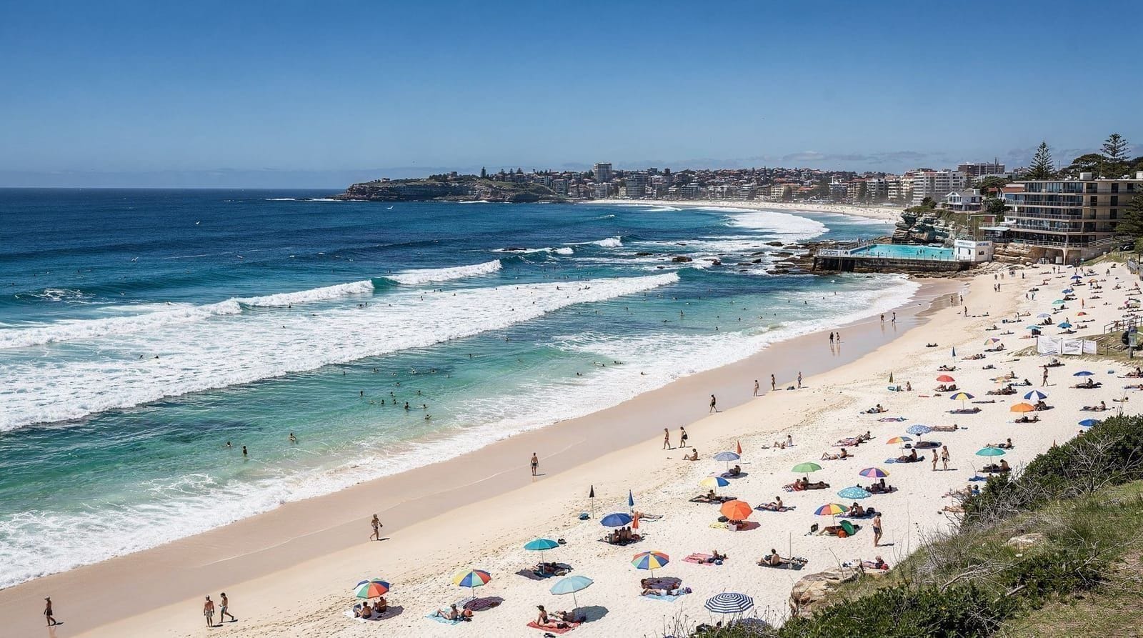
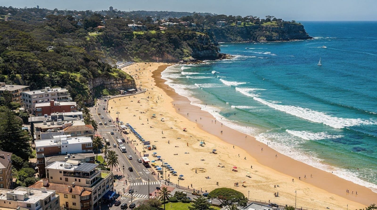
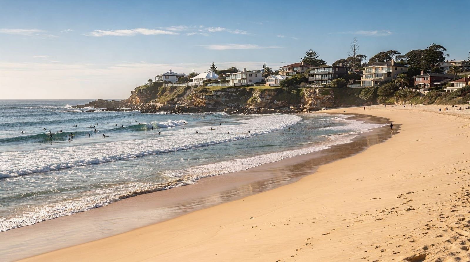
This accessibility makes Cronulla the most practical beach day trip in Sydney for visitors who do not have a car and find Bondi’s buses frustrating. The beach itself is 6 kilometres of continuous sand — far longer than Bondi’s one kilometre — and is divided into several named sections: Elouera Beach (the most popular surfing beach), North Cronulla, Cronulla Beach (fronting the main shopping street), and South Cronulla.
The beach and surfing
Cronulla faces south-east and picks up consistent surf from both southerly and easterly swells. The local surfing community is tight-knit and has been for decades — Cronulla has produced a disproportionate number of professional surfers for its size. Elouera Beach, at the northern end, is the best surf break and tends to attract intermediate to advanced surfers. The Cronulla Beach section near the shopping strip is more beginner-friendly.
Surf Life Saving patrols operate across multiple beach sections simultaneously — Cronulla has three clubs (Cronulla Surf Life Saving Club, Elouera, and North Cronulla) covering different sections of the beach. Always check which section is patrolled and swim between flags.
The exposed nature of the beach means southerly swells can make conditions rough. In summer, northerly winds create cleaner conditions; winter southerlies are powerful and best left to experienced surfers.
Wanda and Greenhills — the quieter northern extension
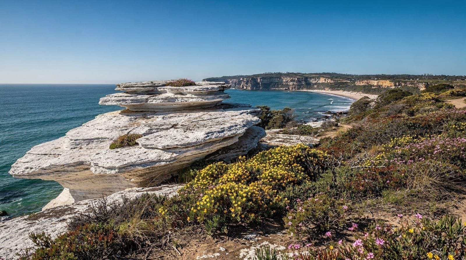
North of Elouera Beach, the sand continues as Wanda Beach and Greenhills Beach — a long, relatively undeveloped stretch that is part of the Kamay Botany Bay National Park. These beaches receive the same southerly swells as Cronulla but with significantly fewer people. On a typical summer weekend, Wanda has perhaps 10% of Cronulla’s crowd.
The access road to Wanda and Greenhills is closed to private vehicles (it is a National Parks access road), which means reaching these beaches requires either a car with a park permit, or a 30-minute walk along the beach from Elouera. This barrier is exactly what keeps them quiet. Wanda Beach also has historical significance — it was the site of Australia’s largest peacetime disaster, the 1938 Surf Carnival drowning tragedy that killed 5 swimmers during a rescue demonstration. A small memorial stands near the beach access.
The Kamay Botany Bay National Park coastal section here is also one of Sydney’s best locations for land-based whale watching from June–August, as humpback whales pass within 1–3 kilometres of the coast on the northward migration.
The Cronulla shopping strip and eating
Cronulla Street and the surrounding blocks function as a genuine town centre — not a tourist precinct. This is somewhere Sydneysiders live, shop, and eat. The range of cafés and restaurants is respectable: Shuk on Cronulla Street does excellent shakshuka and Middle Eastern-inspired breakfasts (AUD 18–26), Aqua Dining on The Esplanade has good fish and unobstructed beach views (mains AUD 32–45), and the standard of coffee is much higher than the typical beach suburb. A flat white costs around AUD 5.25.
Bundeena and the Royal National Park gateway
This is Cronulla’s best-kept secret. From Cronulla Wharf (a 10-minute walk from the station), the Bundeena Ferry crosses Port Hacking to the village of Bundeena in approximately 15 minutes, running roughly hourly. Adult fare is around AUD 7.50 each way on Opal.
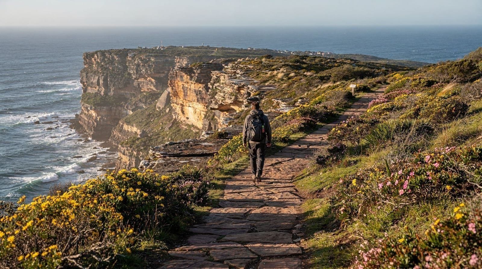
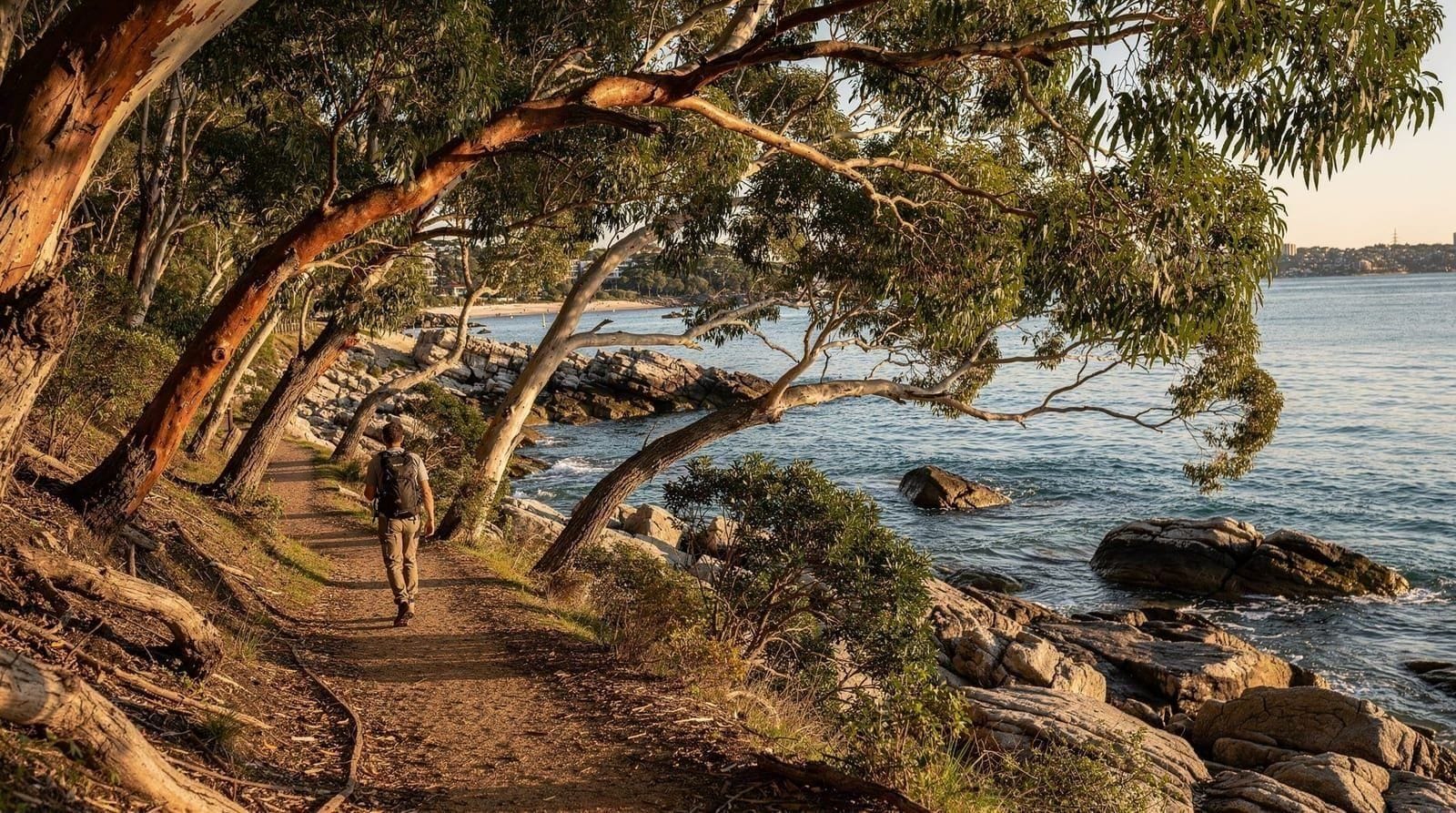
Bundeena sits within the boundary of Royal National Park, Australia’s oldest national park (established 1879). From Bundeena, you can walk north through the park on the Royal Coastal Track — a spectacular 26-kilometre clifftop route to Otford (at the park’s southern boundary) that passes secluded beaches including Jibbon Beach, Marley Beach (a swimming hole surrounded by heathland), and the dramatic clifftop section above Wattamolla lagoon.
Join a guided Royal Coastal Walk from Bundeena to WattamollaThe full coastal walk is typically done as a two-day overnight hike. Day walkers can reach Jibbon Beach (1.5 km from Bundeena) or Marley Beach (5 km) and return on the same path. The Royal National Park guide covers the full walking options and park access in detail.
Kamay Botany Bay National Park
Immediately north of Cronulla, Kamay Botany Bay National Park preserves the southern shores of Botany Bay — the site of Captain Cook’s first landing in Australia in 1770. The national park encompasses the headland at Kurnell Point, the Botany Bay beach, and a series of historical interpretation sites related to the 1770 landing and the subsequent colonisation.
The Botany Bay beach at Kurnell (accessible by car, approximately 15 minutes from Cronulla) is wide, calm, and usually uncrowded. It faces north into the bay, making the water substantially calmer than Cronulla’s ocean beaches. This is a good option if you want a day on the sand without surf. The Cape Solander Drive within the park leads to Cape Solander lookout, one of Sydney’s best land-based whale watching points during the May–November migration season — the cliff rises directly above deep water and whales frequently pass within 100–200 metres.
Captain Cook’s Landing Place at Kurnell is the specific site of the 1770 landing, marked with memorials and a small interpretive centre (entry approximately AUD 5). The area is historically significant and relatively uncrowded. Parks are open daily; the Kurnell Café near the park entrance provides basic refreshments.
Getting to Cronulla
By train: Cronulla Line from Central, Town Hall, or Circular Quay. Change at Sutherland (some services run direct). About 50 minutes from Central. Trains every 15 minutes on weekdays, 30 minutes off-peak and weekends.
By car: 26 kilometres from the CBD via the Princess Highway. Allow 40–60 minutes depending on traffic. Parking on Cronulla Street and surrounds is metered.
Cronulla fits naturally into a broader south coast itinerary — combine with a day in Royal National Park or continue further south towards Wollongong and the Grand Pacific Drive. See the best day trips from Sydney guide for itinerary options combining Cronulla with Wollongong or Kiama.
Cronulla’s beaches — a closer look at each section
Cronulla’s 6-kilometre beach is divided into named sections, each with a different character:
Elouera Beach: The most exposed and surf-focused section, at the northern end near the headland. Consistent beach breaks, strong local surfing culture. Not suitable for beginners in large swells.
North Cronulla: Slightly more sheltered than Elouera, with a mix of surfers and recreational swimmers. The North Cronulla Surf Life Saving Club patrols this section.
Cronulla Beach (main section): In front of the main shopping strip. The broadest section, most accessible for casual swimmers and families. Cafés and restaurants directly backing the beach.
South Cronulla: The quietest section, backing onto Tonkin Park. Smaller crowd, often better surf quality when wind is light. The Cronulla SLSC patrols here.
Each section is monitored independently during the patrol season (September–April daily, winter weekends). Always check which section has active patrol flags before entering.
Water safety at Cronulla
Cronulla’s exposed south-east orientation means it receives the full force of southerly and easterly swells. Rip currents form at both ends of each beach section and in channels between the sand banks. The surf here is generally more powerful than the Eastern Beaches in southerly swell conditions, and beginners should stick strictly to the flagged area.
In summer, northerly winds flatten the surface and create cleaner, gentler conditions. These are the best days for less experienced swimmers. Bluebottles appear occasionally after sustained northerly winds, typically in January–February.
The offshore rock reef at Shark Point (the southern headland between Cronulla and Gunnamatta Bay) is marked as a no-swim zone due to shark activity. This is a realistic warning rather than over-cautious signage — the deep-water reef attracts bull sharks at certain times of year. Stay within the patrolled beach zones.
Gunnamatta Bay — calm water alternative
On the north-western (harbour-facing) side of Cronulla’s peninsula, Gunnamatta Bay is a protected tidal inlet in Port Hacking. The water here is entirely calm — no surf, no rip currents. There are two small beaches within the bay (Gunnamatta Beach and Hordens Beach) that are suitable for young children and non-swimmers. Opal fare from Cronulla Station to Cronulla Wharf is the same (it is a short walk).
Gunnamatta Bay is also where the Bundeena Ferry departs, making it the practical gateway to Royal National Park.
Combining Cronulla with Royal National Park
The natural extension of a Cronulla beach day is crossing to Bundeena and spending 2–3 hours walking in Royal National Park. Take the 9 am or 10 am Bundeena Ferry (from Cronulla Wharf), walk to Jibbon Beach (1.5 km, 30 minutes, easy) or Marley Beach (5 km, 1.5 hours, moderate), return to Bundeena for a late lunch, then take the afternoon ferry back to Cronulla. This makes for a full and varied day without a car.
Book a Royal National Park day trip from SydneyThe Royal National Park guide has full details on the walking routes and what to expect at each beach. The best day trips from Sydney guide compares Cronulla and Royal National Park with other south coast options.
Honest assessment
Cronulla is underrated relative to its quality and accessibility. The beach is excellent, the town is pleasant, and the Bundeena ferry gives you access to one of Sydney’s best-kept wilderness experiences. The reputation it acquired after a period of local tension in the mid-2000s is largely historical; the suburb today is safe and welcoming for visitors. The Cronulla beaches guide has further detail on individual beach sections and surfing conditions. For a broader south coast day trip that takes in Cronulla, Royal National Park, and Wollongong, the Sydney coastal beaches itinerary provides a structured 4-day framework.
Top experiences
Bookable activities with verified prices and instant confirmation on GetYourGuide.