Best hikes in the Blue Mountains — trails from easy to hard
Sydney: Blue Mountains guided hike with lunch pickup
What is the best easy hike in the Blue Mountains?
The Prince Henry Cliff Walk from Echo Point to Scenic World (about 3.5 km one way, 60–70 minutes) is the most accessible introduction — flat to gently undulating, with continuous valley views and no technical terrain. For a slightly longer but still manageable circuit, the Wentworth Falls Lake circuit (3.4 km) offers waterfall views with minimal elevation change.
The Blue Mountains National Park covers 2,678 square kilometres of sandstone plateau, eucalyptus forest, and creek-carved gorges — home to over 140 km of maintained walking tracks. The range runs from flat cliff-top promenades suitable for families with young children to full-day valley descents requiring navigation experience.
This guide ranks the best Blue Mountains hikes by difficulty and explains what to expect on each, with logistics from Sydney.
Before you go: essentials
Maps: Download the Blue Mountains National Park track map from NSW National Parks (npws.nsw.gov.au) before leaving Sydney — mobile signal drops in the valleys. The Katoomba Visitor Centre at Echo Point also distributes free printed maps.
Trail conditions: Check the NPWS website for current trail closures. Valley tracks can be slippery or closed after heavy rain. The Giant Stairway and Furber Steps are occasionally closed for maintenance.
Water: Carry at least 1.5 litres per person on any walk over 2 hours. Stream water is not reliably safe to drink untreated.
Seasons: Autumn (March–May) and spring (September–October) are the best walking seasons — mild temperatures and lower rainfall. Summer (December–February) can bring dangerous heat on exposed clifftop tracks; start early and carry extra water. Winter mornings are cold (4–8°C) but trails are often in good condition.
Emergency: 000 for emergencies; the Blue Mountains Conservation Society (4782 1372) for non-emergency trail queries.
Easy hikes (suitable for most fitness levels)
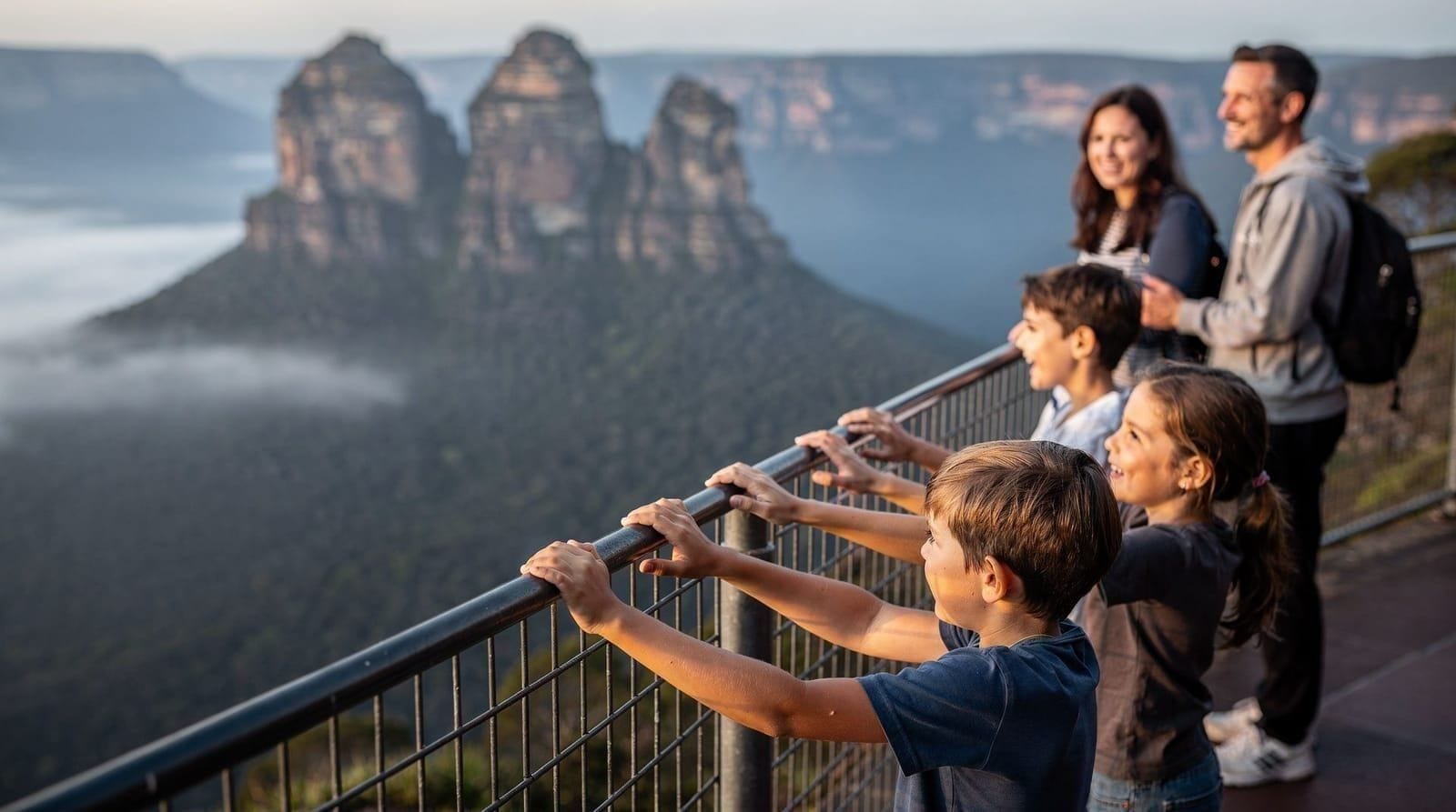
Prince Henry Cliff Walk: Echo Point to Scenic World (3.5 km one way)
Difficulty: Easy to moderate
Time: 60–70 minutes one way
Elevation change: Minimal
Access: Begin at Echo Point car park, end at Scenic World (return by reverse route or Scenic World transport)
The most-walked trail in the Blue Mountains, and for good reason. The path runs along the plateau edge from Echo Point through Katoomba Falls Lookout, Queen’s Cascade viewpoint, and on to Scenic World. Sealed sections alternate with gravel path; interpretive signs explain valley geology. Continuous valley views throughout.
This trail suits anyone who can walk for 90 minutes without major stops. Combined with a descent via the Scenic Railway and return by Cableway, it forms an excellent half-day circuit.
Wentworth Falls short circuit (3.4 km)
Difficulty: Easy
Time: 60–80 minutes
Elevation change: Minimal
Access: Wentworth Falls Station (one train stop east of Katoomba), then 1 km walk to Conservation Hut
The track runs from the Conservation Hut café around Wentworth Lake and to the top of Wentworth Falls (the second-highest waterfall in the Blue Mountains). The view down the multi-tiered falls is excellent; the circuit loop is flat and fully graded. See the dedicated Wentworth Falls guide for the full breakdown.
Scenic World Walkway (2.4 km boardwalk)
Difficulty: Easy (flat boardwalk)
Time: 45–60 minutes
Elevation change: None
Access: Scenic World ticket required (AUD 49); valley accessed via Scenic Railway
Not technically a hiking trail but the closest experience of the valley floor for visitors without full hiking gear. The Scenic Walkway is a flat, fully accessible boardwalk through temperate rainforest — the best way to experience the valley ecosystem without a strenuous descent. More detail in the Scenic World guide.
Moderate hikes (good fitness, proper footwear required)
Furber Steps and Federal Pass (5.5 km circuit)
Difficulty: Moderate
Time: 2.5–3 hours
Elevation change: ~300 m descent and ascent
Access: Start at Echo Point (Giant Stairway descent) or Scenic World base station (Scenic Railway)
The Federal Pass is the valley floor route linking the Giant Stairway base to the Scenic World base station. Combine the Giant Stairway descent from Echo Point, the Federal Pass through the valley, and the Furber Steps ascent back to the Scenic World level. The Furber Steps are steep — 911 steps — and the exit reaches the Scenic World upper level. Return to Echo Point via the Prince Henry Cliff Walk (20 minutes).
This circuit is among the best Blue Mountains half-day walks. Pack lunch and eat at the valley floor.
Jamison Valley: Six Foot Track entry section (variable)
Difficulty: Moderate
Time: Variable
Elevation change: Moderate to steep sections
Access: Starts near Explorers Tree on Great Western Highway, or from Katoomba falls area
The Six Foot Track runs 44 km from Katoomba to Jenolan Caves — a multi-day walk in full. The first section from Katoomba descending into the Megalong Valley via Nellies Glen is a good day-hike option for those with a car (shuttle required for the linear section). The Nellies Glen rainforest is exceptionally beautiful, a steep gully of tree ferns and moss.
Leura Forest and Fern Bower (3.4 km circuit)
Difficulty: Easy to moderate
Time: 1.5–2 hours
Elevation change: Moderate
Access: Leura Cascades picnic area (car or Bus 685 from Katoomba to Leura)
The descent through Leura Forest to the Cascades follows a well-maintained track through hanging swamp and eucalyptus forest. The Cascades are multiple small waterfalls descending mossy rock faces. Return via the Prince Henry Cliff Walk extension offers cliff-edge views. Suits families who want a naturalist experience with moderate exercise. More on Leura in the Leura village guide.
Hard hikes (experienced hikers, full day required)
Grand Canyon Track (6.2 km circuit)
Difficulty: Hard
Time: 3.5–4.5 hours
Elevation change: ~450 m
Access: Blackheath, 15 km north of Katoomba (train to Blackheath Station, then 1 km to trailhead)
The Grand Canyon Track is regularly cited as the best full-day hike in the Blue Mountains. It descends from the plateau at Blackheath through a narrow sandstone canyon — genuinely canyon-like, with overhanging rock walls and the sensation of real wilderness despite being 2 km from the train station. The canyon bottom has a permanent stream, fern groves, and dramatic rock overhang shelters.
The descent and ascent require care on wet days — the track is steep in sections and can be slippery. Not suitable for anyone with significant knee problems.
Train: Blackheath is on the Blue Mountains Line, 15 minutes north of Katoomba. Trains run hourly.
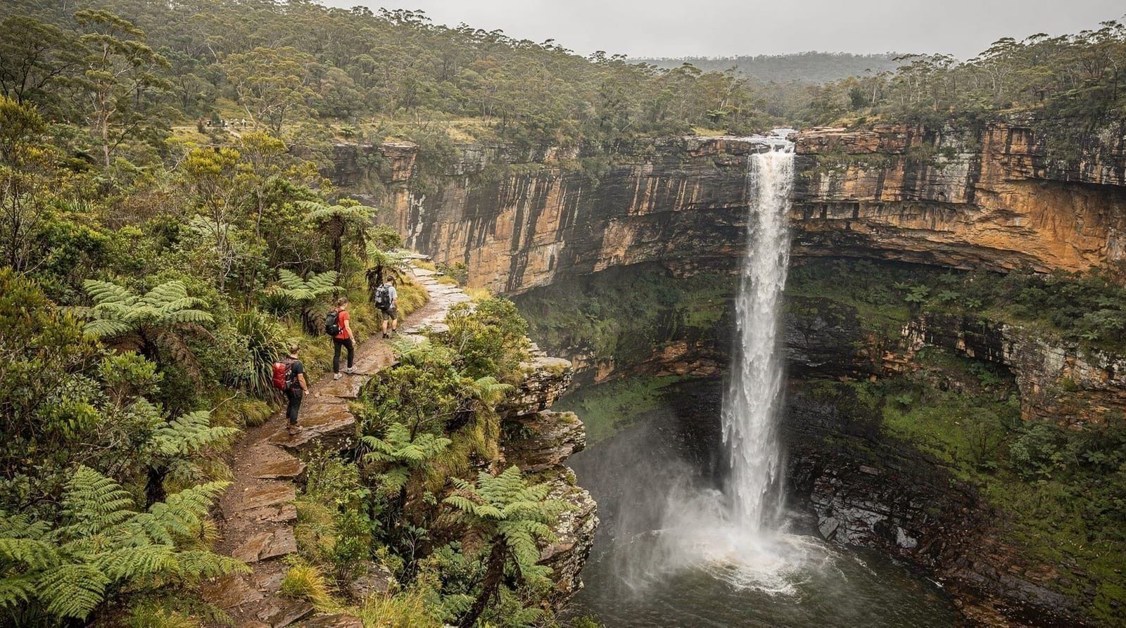
Valley of the Waters circuit (10.5 km)
Difficulty: Hard
Time: 5–6 hours
Elevation change: ~600 m
Access: Conservation Hut, Wentworth Falls (train to Wentworth Falls Station + 1 km walk)
Starting from the Conservation Hut, this full loop descends to the base of Wentworth Falls, follows the valley floor east past Empress Falls and Sylvia Falls, and ascends via Rocket Point Lookout back to the plateau. A long day; carry water for the full distance as there is no reliable water source below. One of the most diverse single-day hikes in the park.
Guided hikes
A guided Blue Mountains hike with lunch and hotel pickup is the most practical option for visitors who want to walk a meaningful trail without managing transport from Sydney. Guides cover the ecology, geology, and cultural history of the track as you go — useful context that trail signs cannot fully replace.
For a smaller-group experience with wildlife focus, the Blue Mountains wildlife bushwalk small group tour covers 4–5 km and adds wildlife spotting — lyrebirds, gang-gang cockatoos, and sometimes echidnas in the undergrowth.
The Blue Mountains day trip guide covers combining a guided or self-guided hike with the broader day-trip logistics from Sydney.
Multi-day walks
The Six Foot Track (44 km, Katoomba to Jenolan Caves, 2–3 days) and the Blue Mountains Crossing (trail network connecting Blackheath and Katoomba over 2 days) are the main multi-day options. Both require advance booking for hut accommodation or camping permits.
Trail conditions by season
| Season | Conditions | Notes |
|---|---|---|
| Autumn (Mar–May) | Excellent | Best overall: mild, stable, low rainfall |
| Winter (Jun–Aug) | Good | Cold mornings, ice possible on high plateau; less crowded |
| Spring (Sep–Nov) | Good | Wildflower season; some afternoon rain |
| Summer (Dec–Feb) | Caution | Heat risk; start before 8 am; carry extra water; bushfire alerts possible |
Top experiences
Bookable activities with verified prices and instant confirmation on GetYourGuide.